

You haven’t got any favourites yet
This is where you can collect inspiration, articles, events and places that interest you.
Click the icon on pages and they’ll appear here.
Your favourites
Inspiration & Articles
Events & Tours
Places
Hiking
INSPIRATION & ARTICLES
EVENTS, TOURS & HIKES
PLACES


You haven’t got any favourites yet
This is where you can collect inspiration, articles, events and places that interest you.
Click the icon on pages and they’ll appear here.
Your favourites
Events & Tours
Places
Hiking
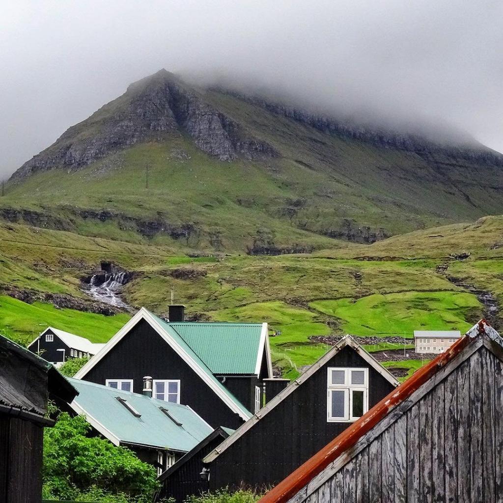
Kvívík - Válur


Link Copied!

-
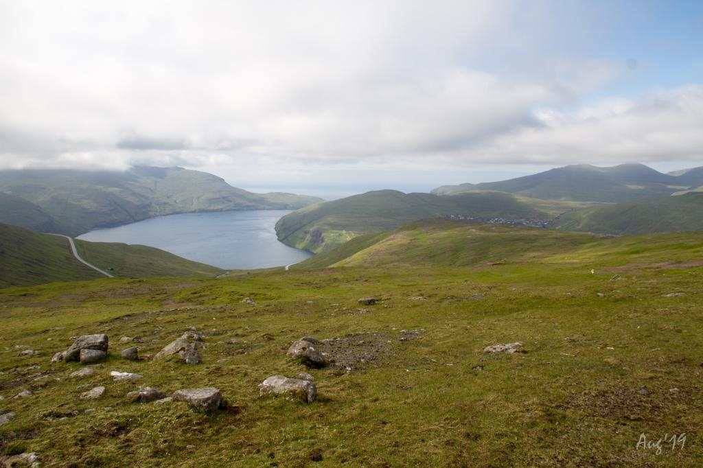
 View south from Havnargøta over the strait Vestmannasund. Photo: Óli Gardshodn
 -
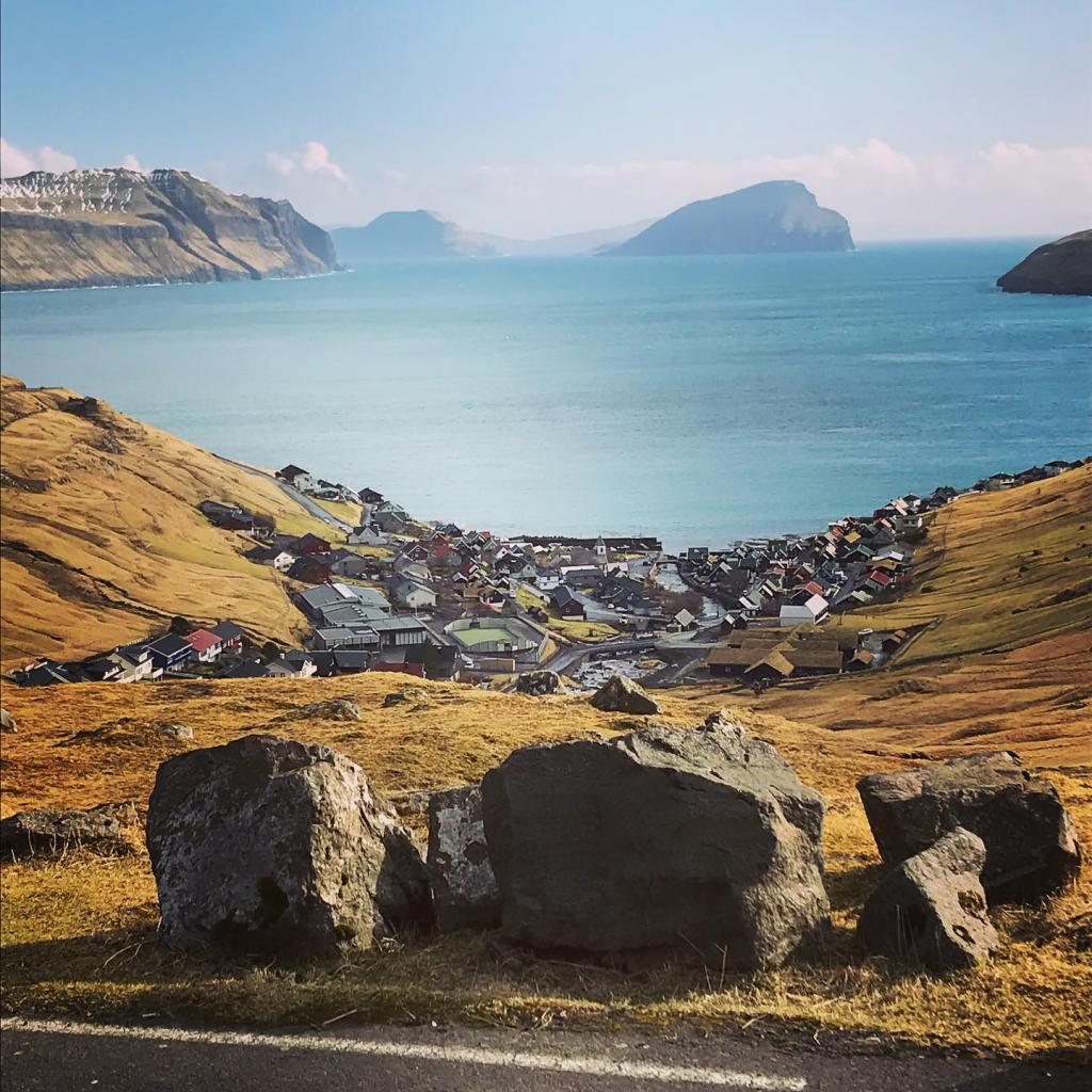
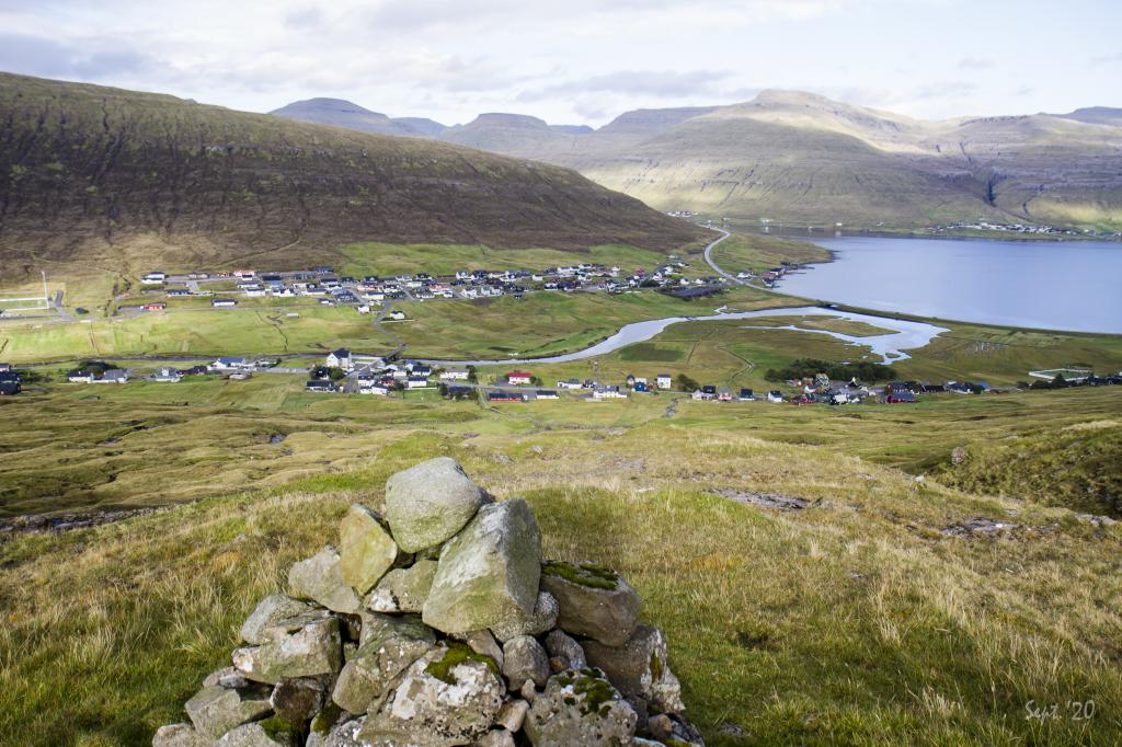
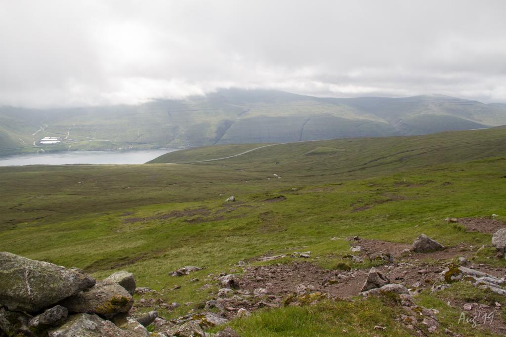 View of the large plain Junkarahagi outfield where you can also see the road to Vestmanna. In the background on the other side of the strait Vestmannasund is the island of Vágar. Photo: Óli Gardshodn
 -
 On the village path across Úti á Sløttum. Photo: Óli Gardshodn
 -
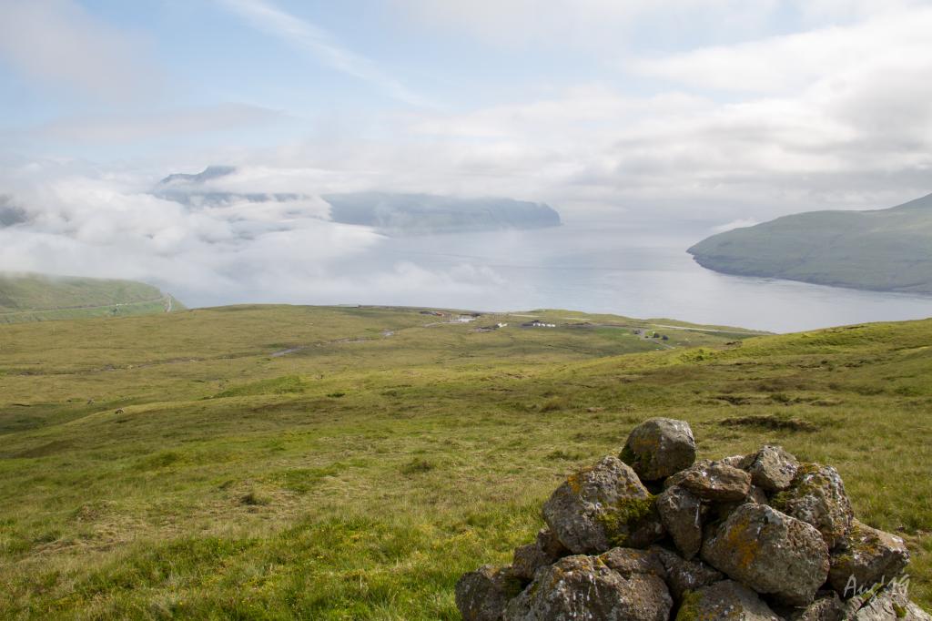
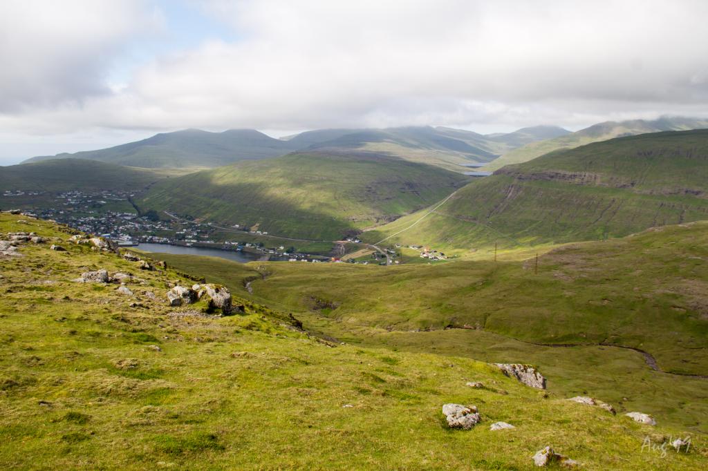
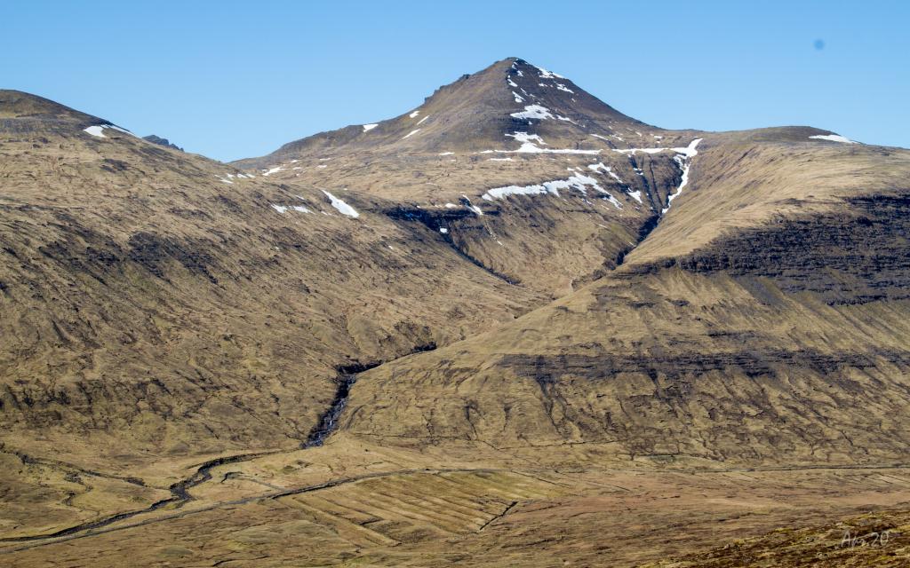
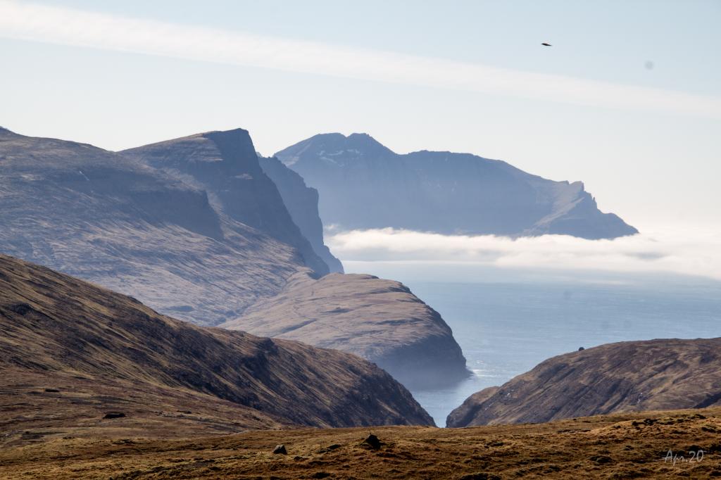
 The view from the highest point in 420m, where in the northwestern direction you can see the strait Vestmannasund. In the right side of the picture, the village Vestmanna can be seen. Photo: Óli Gardshodn
 -
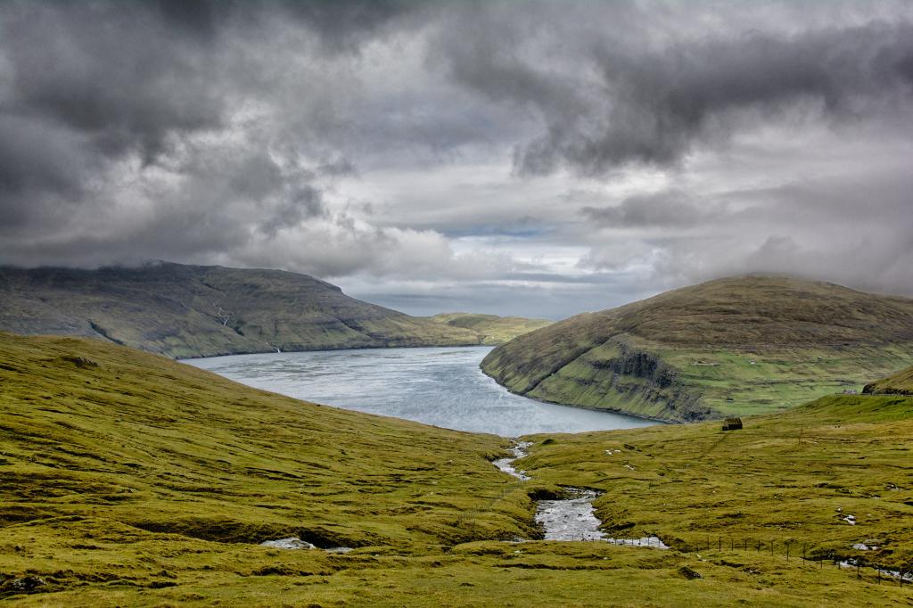
 Up from Brúgvin we look down over the river Breiðá, which flows into the village of Válur. To the right are two of the large dams belonging to the hydropower plant in Vestmanna. Photo: Óli Gardshodn
 -
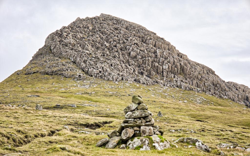
 Up on Brúgvin, the cairns are large and impressive. Photo: Óli Gardshodn
 -
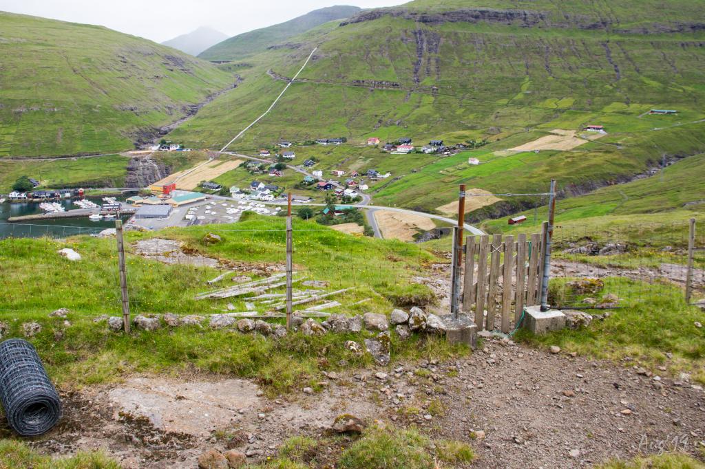 The gate in the outfield fence over the village Válur near Breiðsá. Photo: Óli Gardshodn
A peaceful and easy hike on the western part of Streymoy
If you start in Kvívík, you can park the car in the village, and walk the whole way to Válur. However, it is more convenient to park by the igloos close to the main road above Kvívík. Please park here and not by the sheep sheds, where the first cairn is located.
From here, you go east to the big river, which you follow for about 500 metres until you come up to where an islet, Breiðáhólmur, is in the river. From here, cairns will lead you onward. The cairns are well-kept and easy to spot all the way to Válur.
The village path is not easy to find in Válur. If you start here, go through one of the two gates in the fields outside Válur. One of them is above the sheep shed, east of the crag Veggjamanshamar, and the other is to the west, in the gully Kráargil. You can start in both places. Parking is also available in both locations.
The path can be walked in either direction, weather and mode of transportation deciding which direction is preferable.


Kvívík - Válur
Public transport
Route 100/300 between Tórshavn and Vestmanna stops in Kvívík and Válur.
Arriving by car
Parking, Kvívík
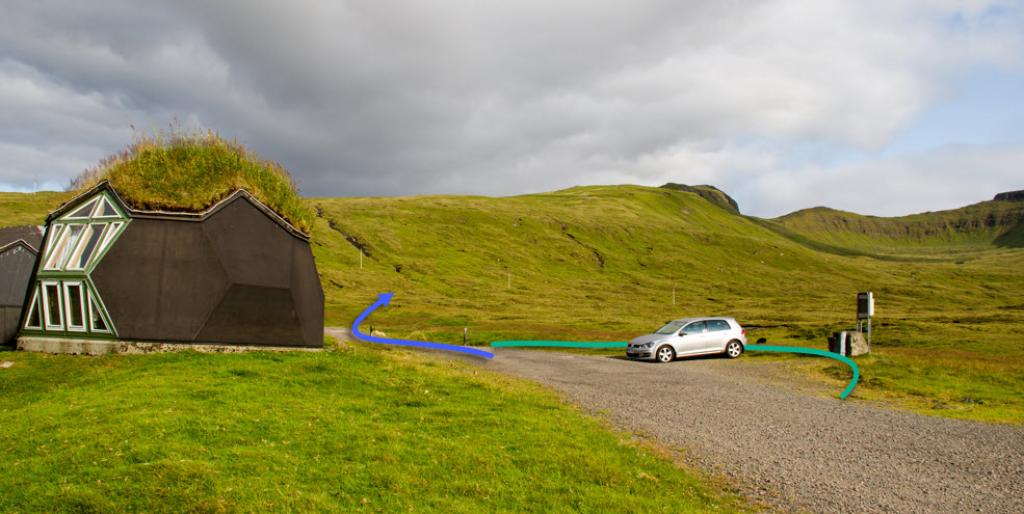
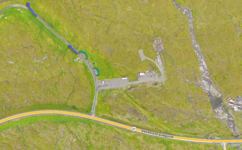
Parking is available by the igloos above the main road. (see the photo)
Válur - Kvívík
Public transport
Route 100/300 between Tórshavn and Vestmanna stops in Válur.
Arriving by car
Parking, Válur
A fairly large parking lot is above Válur by the main road, just below the village path. (see the photo)
-
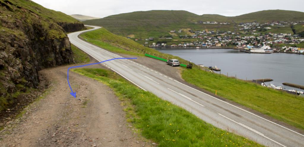 green line shows parking and blue line startingpoint
Kvívík - Válur
Válur - Kvívík
Facts

Duration

distance

Peak

Elevation
 The hike is suitable with children
 Medium
- The path is easy to walk but has a fairly high elevation gain
Medium
- The path is easy to walk but has a fairly high elevation gain
 Grass-covered and good for walking throughout

Region / Trail Difficulty

 Medium
 9 km /
3h
9 km /
3h


 6 km /
5h
6 km /
5h